Interstate 29 has become almost an island road 30 miles north of Grand Forks due to ongoing flooding of the Red River Basin. Water stretches for as far as the drone can see with scenes looking north at 400 feet high. NDDOT has been busy this week monitoring the conditions to keep I-29 open, they had to use inflatable water barriers near the Minto/Warsaw exit.
Shot Description
1) Drone rising above Interstate 29, looking north and showing the ongoing flooding for miles ahead.
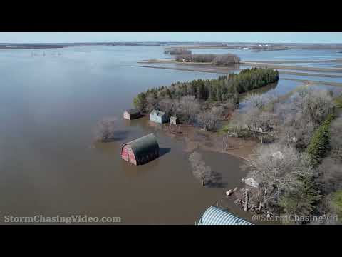
2) Farmstead surrounded by water as drone pans east toward the Red River
3) Drone looking east at I-29 traffic and flooded farmland for miles
4) Looking west toward I-29 traffic
5) Outbuilding surrounded by water
6) Driving on I-29 where inflatable water barriers are installed one mile south of Warsaw/Minto exit.
SID: Jason Bednar
To License This Footage For Broadcast, Contact Video @ StormChasingVideo.com
#NDWX
#i29
#flooding